Waterton Lakes
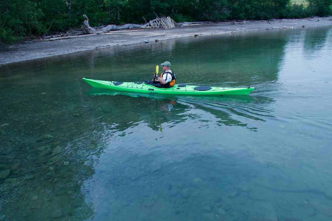
DescriptionThere is an upper and middle Waterton Lake. The upper is a long beautiful mountain lake - due to the way the mountains are facing and the length of the lake it can quite windy - although that might be just what you are after, a bit of a challenge. The middle lake has some sheltered bays so not quite so challenging. The water in these lakes is always crystal clear.
LevelIntermediate - the upper lake is deep and the water is cold so be prepared for that . The reason this is a bit more advanced is that the lake is long and the wind can cause challenges with controlling the kayak. Best to use a dry suit during most of the season.
Distance15 Km from the north end of the middle lake to the south end of the upper lake
Duration:There are numerous distances one can paddle. One could easily make an entire day of exploring the various bays and shorelines or it would be a nice afternoon or morning paddle for shorter distances. This could easily turn into multiple day trips.
Access (Land Agency)Waterton lakes is in Waterton National Park so if you are going there during the regular season one has to pay park fees but once inside the park there is no charge for accessing the lake.
DirectionsWaterton Lakes National Park is off highway 6 going west.
A common take-in point is Linnet Lake parking area next to the middle lake. Here is how you get there: Once into the park stay on the main road, you will see the Lower Lake on your the left hand side down in the valley - keep going. Eventually you will cross Red Rock Creek - keep going straight. A ways further you will see a large bay off to your left and will see a couple of small docks off to the south east and there is a parking lot on the left hand side of the road with access to the docks. There will be a sign that says Linnet Lake it is the same location. Another good take-in spot is where Cameron Creek enters the upper lake. To access the Cameron Creek Take-in spot, look for signs to Cameron Falls - once at the falls go south on Evergreen Ave to the end - the lake will be visible from the parking lot and camp kitchen. A third take-in spot is on the north side of the second bay (Emerald Bay) just before you enter the townsite proper and after the turn to the Prince of Whales hotel - look for a turn out on the left hand side to a gravel beach area directly across the bay from the townsite and docks. Special NotesThe southern end of the upper lake is in the United States. I have paddled to the border (you can see a cutline running through the trees at the border). The yellow line on the map shows the border. I have paddled to south end of the lake and walked around (Goat Haunt) - the border guards are there checking everyone out - to get there and back in one day is a daunting paddle ...but we did it.
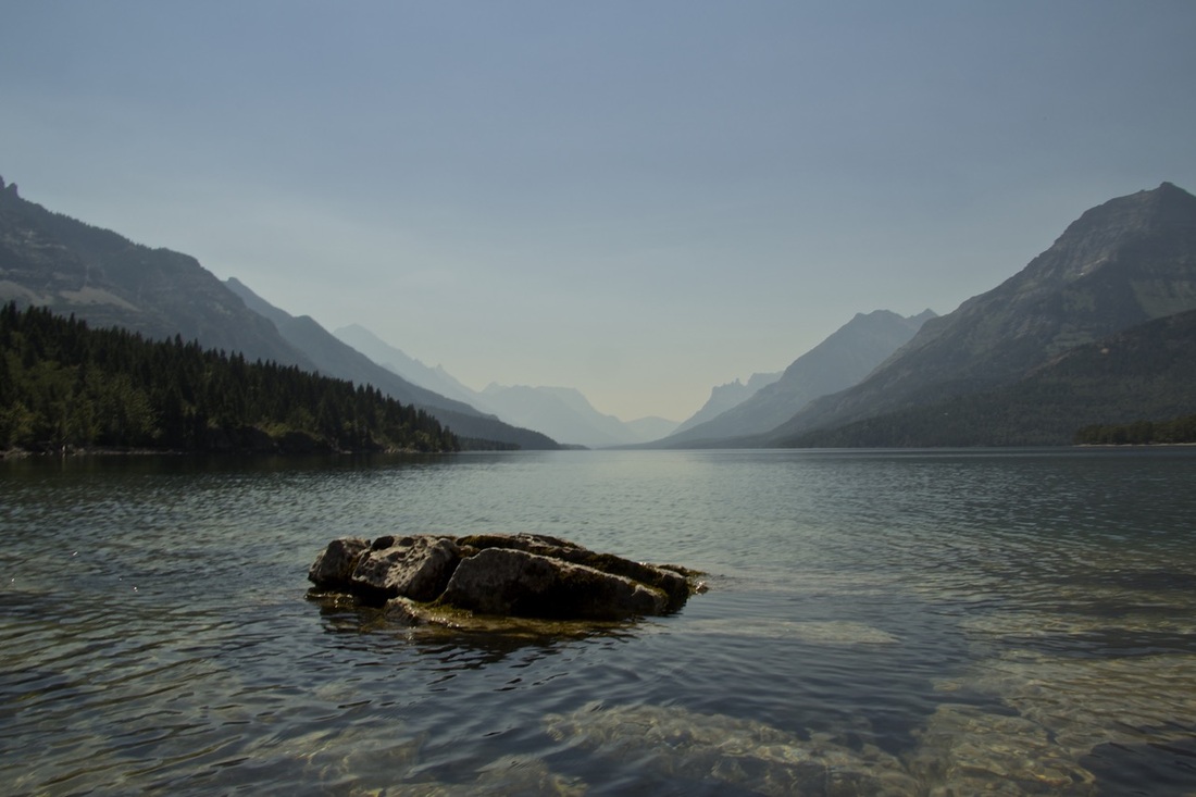
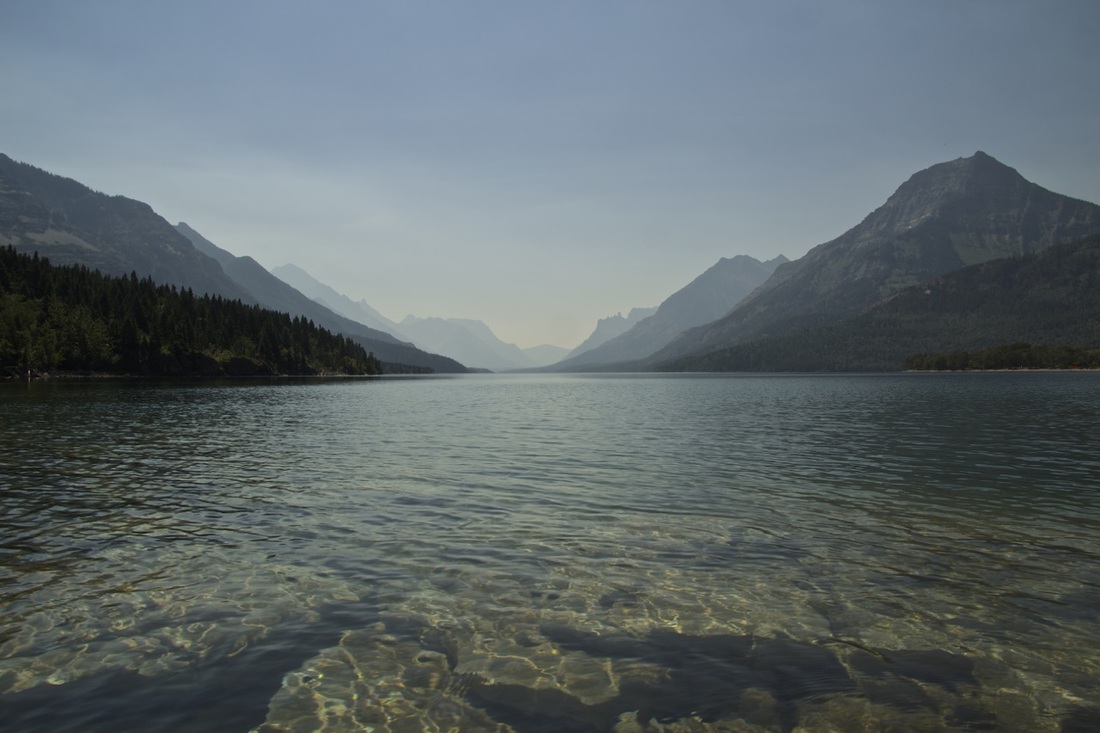
Looking south down the Upper Lake.
|
Maps
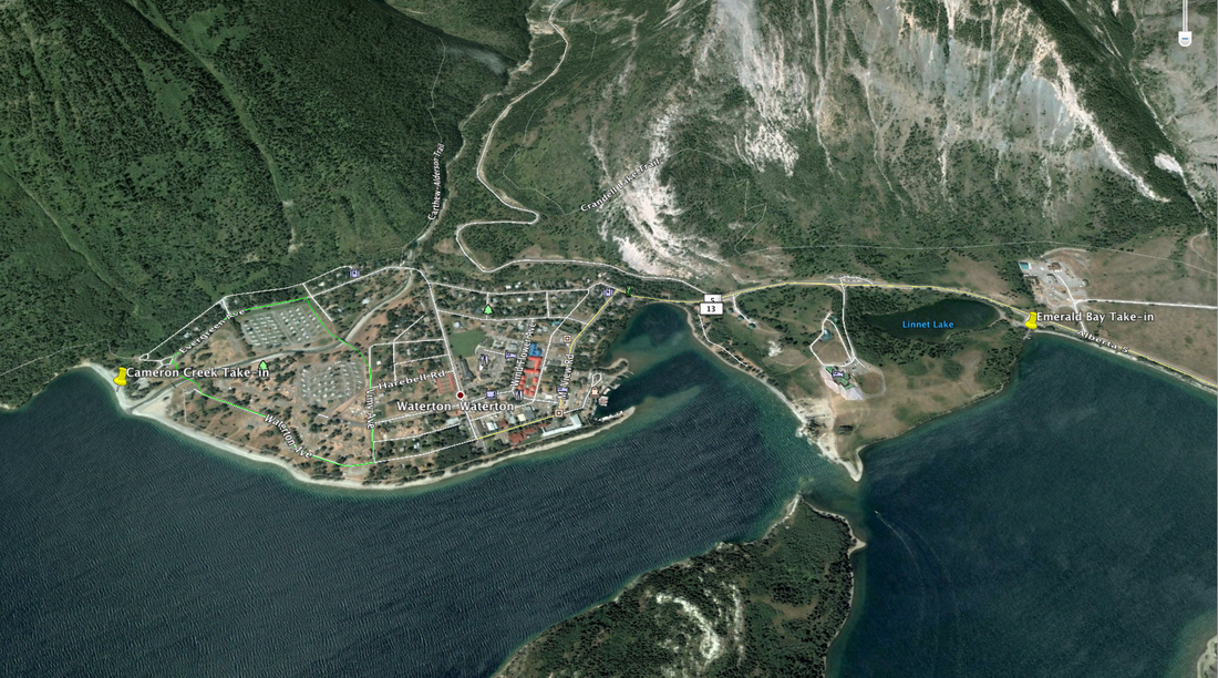
Take-in Locations (click to expand)
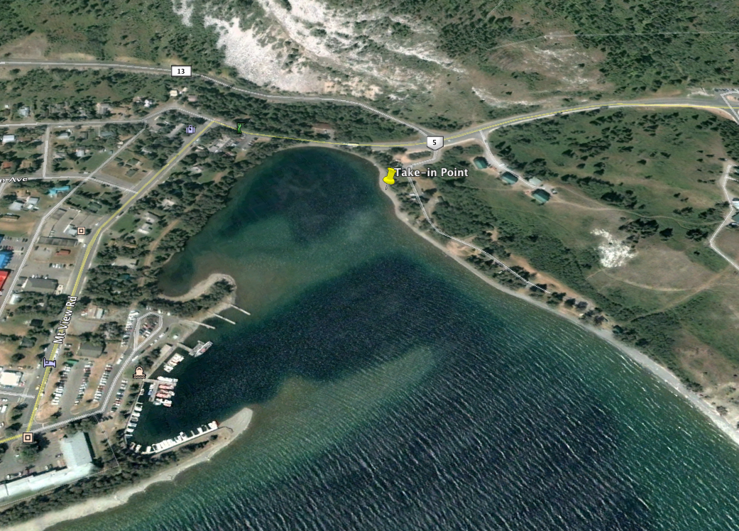
Third Take-in Location
Looking south down the Upper Lake.
|